
Hurricane Erin Creates Risk for Shipping off U.S. East Coast
The outer bands of Hurricane Erin have reached the coastal waters of the mid-Atlantic states, bringing risks to shipping and to the general public in beachfront communities.
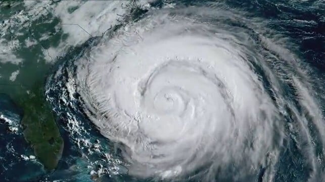
Erin became a Category 1 hurricane last week, and rapidly intensified into a Category 5 storm overnight Friday. In jumping from wind speeds of 75 mph to 160 mph in about 24 hours, Erin became one of the fastest-intensifying hurricanes in history.
After undergoing an eyewall replacement Sunday, the storm weakened, but its horizontal extent broadened. It is producing waves of about 50 feet high near the center of the storm, and wave heights of 12 feet or more extend 400 nautical miles from the center - a "very large area of extremely large and hazardous seas," according to the National Hurricane Center. Satellite AIS data shows that shipping interests are giving it a wide berth.
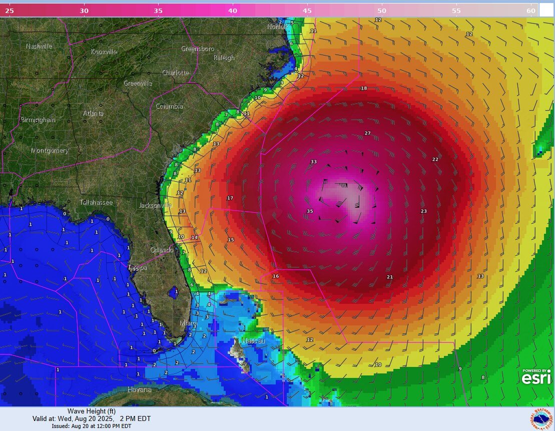
Wind and wave height forecast for August 20 (NHC TAFB)
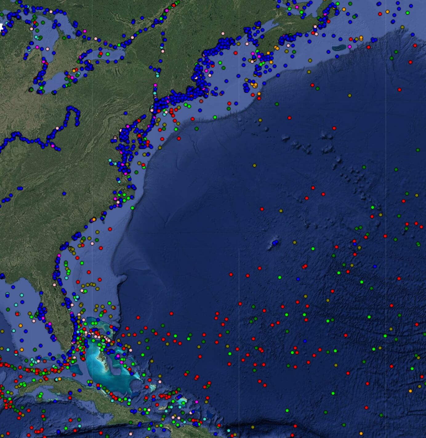
Shipping traffic off U.S. East Coast, August 20 (Pole Star)
The forecast track is expected to keep Erin's high winds far offshore, but storm surge, wave action, rip currents and heavy rains are expected. State and local officials along the eastern seaboard are encouraging the public to stay out of the water until after the hurricane has passed by, and the Coast Guard is repositioning assets to be in place for response needs.
Wave and water hazards pose the greatest threat. Storm surge levels in parts of North Carolina could reach two to four feet, creating a risk of coastal flooding. Residents of North Carolina's Outer Banks could end up cut off for days due to inundation of Highway 12, the tenuous road link that connects the barrier island communities. Hatteras and Ocracoke are under evacuation orders, not because of any imminent hazard, but because they may soon become unreachable for first responders. An estimated 2,000 people departed by Wednesday morning.
As the storm heads further north, authorities are taking precautionary measures. Public beaches in New Jersey, Delaware and the outer boroughs of New York City are closing down in advance due to the risk of rip currents.
Two more tropical systems are in line behind Erin, and NHC is tracking their development. The peak of the Atlantic hurricane season is approaching, and forecasters expect more activity still to come.