
U.S. Navy Explores Drone Tech to Scan Ships for Corrosion
The U.S. Naval Surface Warfare Center Port Hueneme Division is working with a local company to scan existing vessels with video and lidar, then process the data to look for signs of corrosion.
Several companies in the commercial maritime sector have developed similar technology based on image processing - for example, ABS' Corrosion Detection system and DNV's Corrosion.ai product. The Navy's own Office of Naval Research has previously developed a similar tool, dubbed Topside Drone. Port Hueneme Division started from a clean slate, working with remote-sensing tech company Aerial Alchemy to develop a new approach.
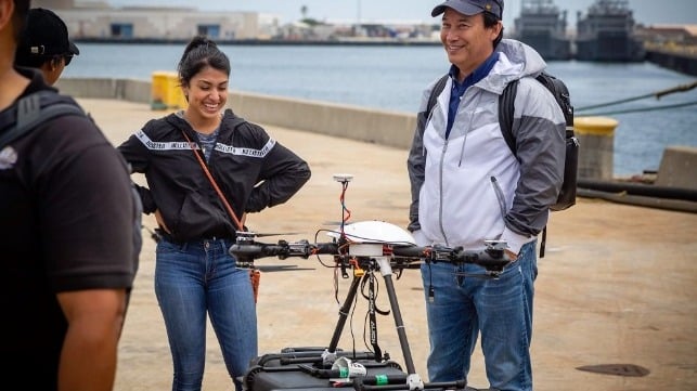
Aerial Alchemy develops medium and heavy-lift UAVs that use sensors equipped with lidar and imaging technology to scan a physical asset and create a 3D digital representation. The partnership’s goal is to explore how to use the company’s drones, its processing system and the visual data collected in order to detect areas that may have corrosion, according to Alan Jaeger, the applications manager for NSWC PHD's Office of Research and Technology Applications.
“The idea . . . is whether we can use various sensors to identify that information without having to put human eyeballs on it," Jaeger said. "If we can, then the next step is putting that on drones or unmanned aircraft, so we don't have to send a sailor on a ship. We can send a drone, and it can scan equipment and identify corrosion or undersurface damage, for example. If we can get that data, then we can start pre-planning for maintenance, preventative maintenance and repair."
This is Aerial Alchemy’s second project with NSWC PHD. The first focused on proving the stability, reliability and accuracy of the company’s UAVs to successfully create an “as-built” digital model of USS Independence (LCS 2), which is used as a baseline digital twin.
With the second project, the team is drawing on the red, blue and green sensor data that a visible camera yields, as well as a more sophisticated scanning system that finely parses different wavelengths of light. This aids remote detection and and identification of the chemicals generated during corrosion.
According to Spaulding, the technique only works well if the sensor data is paired with a stable UAV platform, precision navigation and advanced computational analysis. When ready for deployment, "this solution should provide a more objective rating of surface deterioration much more efficiently, cost-effectively and safer than a human inspector could," he said.

that matters most
Get the latest maritime news delivered to your inbox daily.
The team is starting out by testing its sensors and analytical techniques in the lab. If it scales well, it could have commercial potential outside of the Navy, Spaulding said.
"Navy warships are some of the most sophisticated machines globally, and the nature of combat systems with compound curvature and multiple angles, combined with composite materials, antennas and sensors create complex geometries. If our technology can be demonstrated on combat systems, then it will have applicability on other parts of the ship that are less complex," he said.