
Enabling Smarter Decision-Making in Complex Times for Maritime Sector
Has working in maritime ever been simple? For thousands of years, seafarers have had to contend with the challenges of weather and waves, understand the laws of the sea, navigate safely, and protect their fellow mariners.
At its core, safely operating ships has always been a difficult task, and all of these challenges persist today. But a range of modern challenges, from increasing safety standards and new rules that govern how shipping operates, through to innovative technologies and the urgent need to decarbonize, are all increasing complexity amid great macroeconomic and geopolitical uncertainty.
Supply chain disruption is now the norm, not an unexpected event. The ongoing impacts of Russia’s invasion of Ukraine continue to reshape the global trade map and generate new risks for anyone doing business at sea.
The industry needs lifelines as it charts its course to a more profitable, safe, and sustainable future. A huge innovation of the past decade has been the growing recognition, at sea and ashore, of the ability and power of marine geospatial data – particularly navigational data – to augment decision-making.
Digitalization: a game-changer for data accessibility
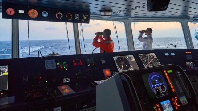
Shipping’s data revolution has been well documented. But navigational data is one of the most concrete and tangible expressions of its impact to date. The switch from paper to digital charts, via the mandatory carriage of ECDIS, was only fully realized in the middle of the last decade, for example, but digitally enabled charting and navigation is now taken as a norm by most mariners and seafarers.
The next few years promise to be similarly transformative. With technological advancements and improved satellite connectivity, crucial navigational and safety updates will be delivered in near real-time – dramatically improving the way data is shared from shore to ship.
With more dynamic data delivery, seafarers will be able to optimize their passage planning, voyages, and port calls, helping to minimize costs and fuel consumption. All of this is enabled by marine data and particularly navigational data. After all, to be able to optimize a vessel you need to have a clear understanding of its place in space and time – and navigational data provides this trusted foundation to base optimization decisions around.
Evolving standards unleashing next-generation navigation solutions
Meanwhile, the coming years are going to see an evolution in the types of navigational products and services that mariners use onboard, and that ship operators and managers use for planning from the shoreside.
The International Hydrographic Organization (IHO)’s new S-100 data framework will create a new standard for data exchange in the maritime industry. These new technical standards provide a shared format for new maritime data products, enabling a greater breadth of data to be integrated into a single view.
The new standards will enable a next-generation leap in navigational products and services. They will also support the protection and improvement of marine habitats, coastal communities’ national resources, and national infrastructure.
S-100 will enable greater safety of life at sea outcomes, and promote enhanced situational awareness, advanced marine traffic management, more precise navigation decisions via increased granularity of bathymetric data, and ultimately more connected ships. It’s not hard to see why all of these benefits are significant in a time of increased complexity, with S-100 acting as an underpinning enabler of augmented decision-making.
The power of trust in uncertain times
At the heart of all these changes is the mariner. Ultimately, it is their needs that need to be met first, because the needs of mariners are deeply linked with safe and sustainable operations at sea. The mariner of the future may well have an entirely different skillset to the mariner of today and will certainly be even more digitally aware and ready to adapt to a more intelligent and connected vessel ecosystem.
All of these factors combine to increase the role and prominence of trust – a currency that the shipping industry has relied on for centuries. If data is to be used to strengthen decision-making, that data needs to be dependable, from a trustworthy source, and a track record of success.
As we transition towards an increasingly digital industry, the UKHO continues to innovate to ensure its ADMIRALTY Maritime Data Solutions are fit to support navigation today and for generations to come.
By trusting the ADMIRALTY portfolio, users can navigate with confidence knowing they have access to the latest data to ensure the safety of their vessel, crew, cargo, and environment. This data is compiled, assessed, and verified by a world-class team of experts at the UK Hydrographic Office to provide users with the safety and commercially critical information they need.
To find out more about how ADMIRALTY products can help you navigate complexity and ensure safety, sustainability, and profitability at sea, visit our website:
https://www.admiralty.co.uk/trust-admiralty
This article is sponsored by the UK Hydrographic Office
The opinions expressed herein are the author's and not necessarily those of The Maritime Executive.