
Royal Navy Tests Software for Radar-Based Bathymetric Survey
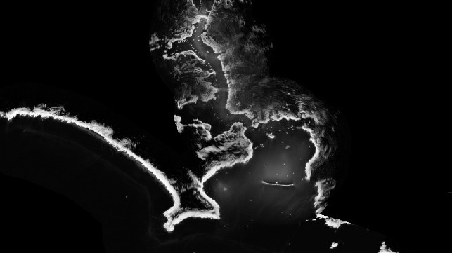
The Royal Navy has tested cutting-edge software to map the seabed close to shore in hours – not days or weeks. Survey vessel HMS Magpie was able to chart the waters around Plymouth purely using the same kind of regular radar system installed on shipping the world over, along with a specialized computer program which measures wave height.
Using that data and information about currents, the software can produce a detailed profile of the seabed in a matter of hours – without the ship or boat having to physically sail over the area being surveyed.
All the system needs is wind and a swell to generate waves, plus computing power. It is not as detailed as the scans Magpie or other Royal Navy survey vessels can produce with their high-tech sonar suites, and it only works close to shore.
But the method – known as radar bathymetry and developed by scientists from the National Oceanography Centre in Liverpool and MOD experts from Defence Science and Technology Laboratory – could be vital in times of peace or war when time is critical.
“By analyzing the sea clutter images of waves visible on standard marine radars a bathymetric profile (that's the depth) and surface current assessment is created,” explained the lead project scientist at the National Oceanography Centre, Paul Bell. “This technique could allow the remote charting of both shallow water and currents from a standoff distance of several nautical miles and could be employed by all Royal Navy Ships using the navigation radars that are already fitted with.”
Given her small size, Magpie doesn’t carry the standard navigational radar used by the rest of the Royal Navy's fleet, so one was temporarily installed on a roof rack.
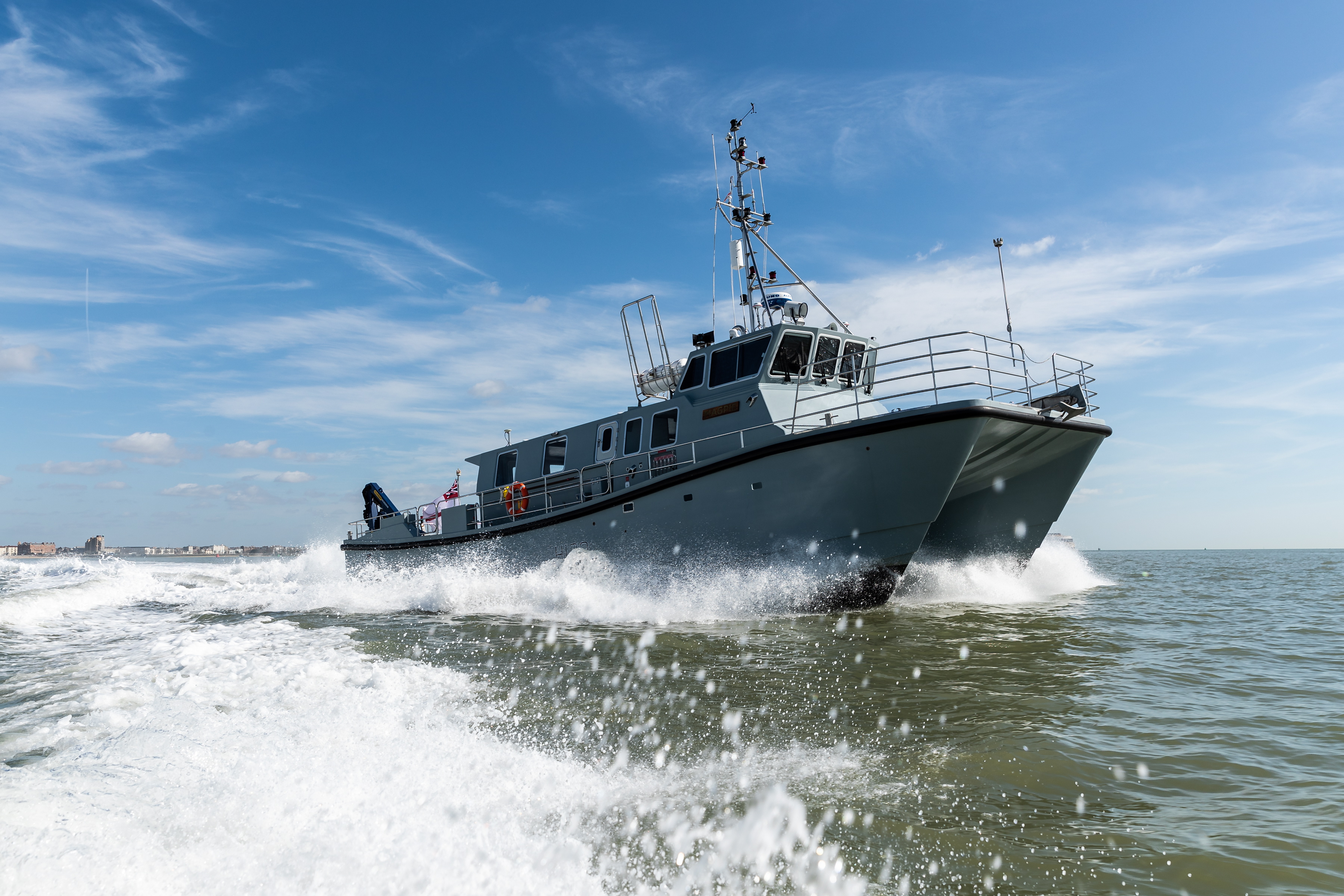
HMS Magpie off Portsmouth (Royal Navy)
It would take the ship perhaps a fortnight to map the ocean floor on the approaches to Plymouth naval base and the Sound with her sonar. It took the software just hours to do the same – and one by-product was an accurate composite map of the area’s coastline.
Time could be the difference between life and death in the aftermath of a natural disaster, with a possible shifting seabed preventing the usual access to harbors or beaches - or an amphibious landing on or evacuation from poorly/uncharted shores.

that matters most
Get the latest maritime news delivered to your inbox daily.
At present the software is still in development, but the goal is to integrate it with the Royal Navy’s existing navigational radar and systems – no new equipment would be required in most cases, just upgraded software.
This article appears courtesy of Royal Navy News and may be found in its original form here.
The opinions expressed herein are the author's and not necessarily those of The Maritime Executive.