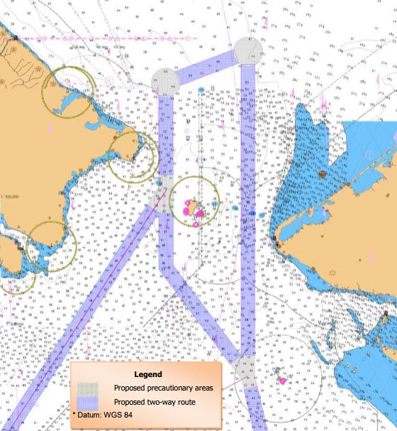
U.S., Russia Propose Bering Strait Traffic Routing
In response to increased Arctic shipping traffic, the U.S. and Russia have proposed a system of two-way routes for vessels to follow in the Bering Strait and Bering Sea.
The nations jointly developed and submitted the proposal to the IMO to establish six two-way routes and six precautionary areas.
Located in U.S. and Russian Federation territorial waters off the coasts of Alaska and the Chukotskiy Peninsula, the routes are being recommended to help ships avoid the numerous shoals, reefs and islands outside the routes and to reduce the potential for marine casualties and environmental disasters.
The eastern Bering Sea is a relatively shallow body of water with average depths ranging from six to 75 meters (20 to 246 feet). These shallow depths offer minimal under keel clearances as compared to the waters surrounding the western Aleutian Islands and North Pacific Ocean where offshore water depths are well over 900 meters (2,900 feet) deep. The shallow depths of the eastern Bering Sea are especially problematic for mariners because some nautical charts for this area are using hydrographic data obtained over 100 years ago with a leadline at spacing intervals in excess of a mile apart.
The proposed two-way routes will be voluntary for all domestic and international ships.

that matters most
Get the latest maritime news delivered to your inbox daily.
No additional Aids to Navigation (ATON) are being proposed to mark the recommended two-way routes and the routing measures do not limit commercial fishing or subsistence activities.