
NTSB Cites Miscommunication and Outdated Chart in $2M Docking Accident
Overreliance on an electronic chart, miscommunication, and an outdated navigational chart, were all factors according to the National Transportation Safety Board in a 2022 docking accident involving a cruise ship that resulted in $2.1 million in damages and impacted cruise ship traffic in Sitka, Alaska for most of the 2022 cruise season. While none of the passengers or crew were injured and the ship only suffered a minor hull indentation, the report highlights issues that the NTSB believes require attention.
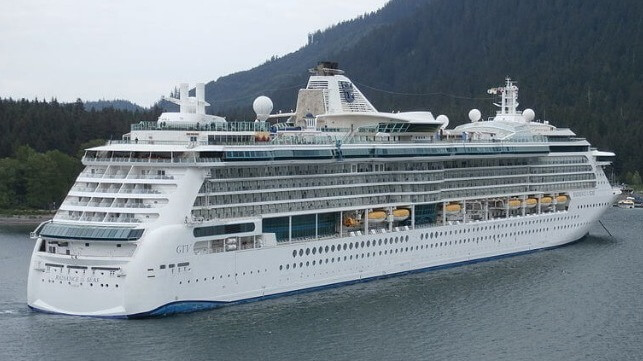
Royal Caribbean International’s cruise ship Radiance of the Seas, a 961-foot long ship that is 90,000 gross tons, was maneuvering to dock in Sitka on May 9, 2022, when the ship backed into the mooring dolphin. As is standard with all cruise ships in Alaska, there were four pilots aboard working in shifts of two, but the master of the cruise ship along with the cruise line had requested that the master and his crew moor and unmoor the ship to refamiliarize themselves with Alaska ports following the COVID-19 suspension of operations.
The master was at the controls with his full bridge team, and there was a mooring team on the stern communicating to the bridge via radio. The cruise ship was making a 180-degree rotation, traveling at approximately 6 knots, and using two bow thrusters and its two azipods. The master, staff captain, and one of the pilots were on the port bridge wing, with the staff captain managing the starboard bridge wing camera. On the bridge, the first officer was at the forward console, the second officer was at another console, and there were both a helmsman and a lookout, while the chief officer and another pilot were on the starboard bridge wing.
As they were reversing and maneuvering, the camera reportedly froze due to a hardware issue. The master was relying on callouts from the bosun over the radio, assuming he was reporting the vessel’s swing clearance when instead the bosun was estimating the distance to the mooring dolphin. The ship’s starboard quarter struck the mooring dolphin damaging three of the four pilings supporting it.
The NTSB determined the probable cause of the contact was the master and bridge team’s overreliance on an electronic chart to identify the pier’s position relative to their planned rotation location, and the master’s misunderstanding of the clearance distances to the pier being called by the crewmember on the stern while the vessel was rotating. They found that the crew of the Radiance of the Seas relied heavily, or solely, on the vessel’s electronic chart and information system (ECDIS) to plan and execute their docking while they also had other navigational technologies, including radars and cameras. Further, the bosun and master did not confirm the type of distances that were being communicated during the docking. The first officer had also stopped calling out the position relative to the dolphin based on the ECDIS.
A contributing factor was also determined to be an outdated electronic navigation chart that the cruise ship was using. In 2021, the terminal’s pier was extended by 395 feet, including adding two dolphins, and an adjacent floating dock, but it was never reported to the National Ocean and Atmospheric Administration (NOAA), the agency in charge of updating U.S. coastal nautical charts. NOAA had no record of the construction until NTSB investigators informed them of the pier’s extension after the incident.
NTSB investigators in the report released today cited two lessons learned as a result of the investigation, voyage planning and reporting port or terminal modifications. They write that, “Reference points for maneuvering should be identified, measured precisely, and reported clearly. Vessel bridge teams should also ensure that they have the most up-to-date data before getting underway and consult with the local pilot(s) on the accuracy of navigation charts to ensure depictions of ports and/or terminals are correct.”
They also highlight the importance of ports and terminals immediately reporting significant modifications to the appropriate hydrographic authority so that charts can be updated.
Top photo by PhilipRJ 89 -- CC BY-SA 4.0 license