
Video: Australia Completes 3D Survey of WWII Japanese Submarine
Australia completed its first 3D survey of a wreck in deep waters off the coast near Darwin. It is hoped that the unique project which took three years to complete will provide critical new details about a WWII-era Japanese submarine sunk by the Australians and will also provide information for the preservation of the site which is recognized as a war grave by both the Australians and the Japanese.
It was January 1942, during some of the darkest days of World War II. The Japanese submarine I-124, which had been built in the 1920s, was deployed off the northwest coast of Australia laying underwater mines. The submarine was part of an Imperial Japanese Navy squadron that had been waging covert operations against Australia’s north, laying mines in waters near Darwin in a bid to intercept allied vessels and close the port.
The Australian Navy responded to an unsuccessful attack on a U.S. oil tanker in the region by one of the Japanese submarines by sending three corvettes to the scene. The I-124 fired a torpedo at the first ship to arrive, the HMAS Deloraine, which in turn detonated dozens of depth chargers in a sustained attack that sank the Japanese submarine. All 80 crew members died on board, with the vessel sinking between Darwin and Bathurst Island. Only weeks after the I-124 was sunk, 236 people were killed in the bombing of Darwin.
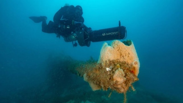
Eight decades after the corvettes deployed by the Royal Australian Navy sunk the Japanese Navy submarine I-124 on January 20, 1942, a team of researchers completed a 3D survey using specialized cameras mounted to underwater scooters. According to Northern Territory senior heritage officer and maritime archaeologist Dr. David Steinberg, a remote location, strong rides, murky waters, and depth all presented hurdles that had prevented them from previously completing surveys of the site.
The archeological mapping marks the first-time divers have descended 50 meters (164 feet) at the Beagle Gulf, northwest of Darwin in a bid to capture a deeper understanding of the vessel to inform future research and site management. Previous surveys have been restricted to remote sensing which provides valuable data but was limited in comparison to diving to the site.
The submarine was the first wreck in Australia to be protected under the Commonwealth Historic Shipwrecks Act 1976 which has since been replaced by the Underwater Cultural Heritage Act 2018. Access to the site by the public is by permit only. In 2018, former Japanese prime minister Shinzo Abe visited Darwin, and earlier this year a plaque bearing the names of the 80 submariners was unveiled at Darwin's Dripstone Cliffs as part of the measures to preserve the historical significance of the battle both to the Australian and Japanese people.
“By sending experts down to the wreck, we give ourselves the best chance to get the most accurate picture of what happened 80 years ago, and the condition of the wreck today,” said Chansey Paech, the Northern Territory Minister for Arts, Culture and Heritage.
He added that the expedition is critical in understanding the role that the Northern Territory played in the defense of Australia during WWII, and will help inform how it protects and maintains the important historic site. They also hope to add to the understanding of the submarine and modifications made by the Japanese during World War II. While it was one of four vessels in a class built to lay mines, three were destroyed during the war.
According to David Steinberg who led a team of archaeologists, technical divers, a filmmaker, and a cultural liaison officer on the expedition aboard Paspaley Pearls’ research vessel Marilynne, the 3D survey was able to capture accurate details on the state of the submarine and the surrounding area. He said it would provide a baseline for future study.
The team was also able to understand how quickly the site is deteriorating, and whether there are ways to preserve the war grave. “The level of accuracy and detail that's been captured is just remarkable with these new technologies and new advances in maritime shipwreck mapping," Steinberg told News Corp Australia.
“The wreckage of the I-124 submarine is an iconic reminder of our history and this expedition will hopefully provide new information about how we can care for this site,” said Tanya Plibersek, Commonwealth Minister for the Environment and Water.
Findings of the survey have been shared with the Japanese authorities and a container of sand from the seabed was to be shared with the families of the crew. Plans call for a documentary revealing the findings from the survey to be released next year on the anniversary of the bombing.