
ECDIS: What Happens When the GPS Signal Goes Away?
The U.S. Maritime Administration issued U.S. Maritime Alert 2018-004 A “Possible GPS Interference – Eastern Mediterranean Sea” on March 23 in in response to reports of GPS disruptions and interference from multiple vessels and aircraft between Cyprus and Port Said, Egypt. These reports come on the heels of multiple warnings by the same agency in 2017 of GPS disruptions in the Black Sea, primarily off the coast of Novorossiysk, Russia. These same warnings reaffirmed that GPS disruptions are a global concern and provided guidance for reporting to the U.S. Coast Guard.
Anecdotal reports abound of GPS disruptions ranging from the accidental jamming of GPS signals in San Diego by the U.S. Navy to the intentional use of GPS jammers by truckers. The Navy communications exercise inadvertently affected GPS-based devices ranging from ATM machines to air traffic control. For truckers both in the U.S. and overseas, the jamming frees them from the oversight of companies and regulators tracking routes or work hours. Use of these jammers by truckers in the vicinity of airports have affected operations both in Newark, NJ and Philadelphia, PA.
In the Black Sea in 2017, vessel captains reported having to resort to the use of paper charts, as well as delving into the lesser-used functions of their ECDIS units. Specifically, they used the dead-reckoning (DR) modes of their ECDIS with a radar overlay to accurately plot their positions. By using various combinations of navigation tools, the vessels were able to maintain their situational awareness and safely navigate to port.
Recognizing the risk…
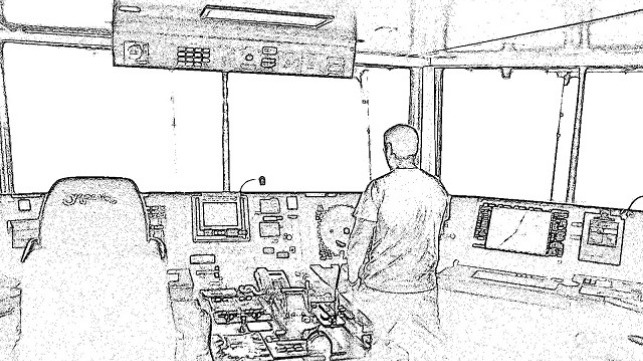
The primary concern among masters, mates and pilots should be the recognition of the loss of accurate GPS positioning. Once this is recognized, mitigation of the situation can commence. But how does one determine that the seemingly-magic GPS black box is no longer providing accurate position-fixing? This can be accomplished in a variety of ways, and the method depends on where you are in the world. It also depends on what navigation tools are available. With the push for “paperless” ships, you might have to use your ECDIS in ways you might not have imagined (or practiced!) yet.
Coastwise
If you are navigating coastwise, there are aids to navigation (ATON) from which you can obtain ranges and bearings to compare with the GPS position. The plotting of these ranges and bearings in comparison with a GPS fix at the same time will give you a good idea as to whether or not the GPS is operating as advertised. This is easily done on paper charts, but is equally possible on ECDIS units.
Looking solely at the Transas Navi-Sailor 4000 ECDIS, there is an option to “Manually Fix Position” in the drop down menu in the right column. By using this function, the operator can input multiple ranges and bearings, thus fixing the terrestrial position and comparing it to the GPS position.
Also, while navigating coastwise, there will be opportunities to compare the vessel's position to floating ATON (buoys), islands, structures or bottom soundings. Any of these can be visually correlated with the paper or electronic chart to approximate the current position. Overlaying the radar return – particularly when you are navigating near radar-conspicuous coastlines or objects – is another quick, yet effective check of GPS accuracy.
Deep Sea / Offshore
Navigating deep sea, offshore or in areas of coastline that do not lend themselves to navigation, checks of built-in GPS accuracy indicators and expected course-over-ground (COG) and speed-over-ground (SOG) might be the best indicators of GPS position performance. Built-in GPS indicators may consist of a simple stoplight system of lights, where green means the position is good, amber means the position is questionable and red indicates that the position is inaccurate or not obtained.
Further delving into the GPS signal status, the horizontal dilution of precision (HDOP) is a good indicator of how accurate your position might be. For HDOP, the lower the number, the better the signal. An ideal GPS position might have an HDOP of less than 1.0. A HDOP of between one and two is excellent, and the greater the number, the less accurate. Predicted HDOP of greater than six, due to satellite maintenance, have sparked warnings from the U.S. Coast Guard in the past.
Unless operating in an area of erratic high currents, the navigator will normally be able to predict the anticipated COG and SOG. If the GPS starts providing an unexpected COG/SOG, it should be viewed skeptically until proven correct. While not a guaranteed indication of GPS issues, it is a clue that all might not be as expected.
Mitigating the risk…
Whether you are paperless and using ECDIS for your primary navigation or still using paper charts, the next steps are pretty much the same. It’s time to go old school and start dead reckoning (DR) and using everything at your disposal to determine the vessel’s position. On paper charts, dead reckoning your position is nothing new, nor is plotting visual or radar bearings and ranges.
For ECDIS users, this will entail changing your position sensor input. Namely, your primary position might become either DR (dead reckoned) or EP (estimated position). The benefit of using EP on Transas units is the ability to input the expected set and drift, as well as having a vector projecting your position up to 24 minutes ahead. The Navi-Sailor 4000 in DR mode will not provide you with the vector to look ahead and determine the probable future position.
Plotting of ranges and bearings to known land masses or ATON can now be done on either the ECDIS or paper chart, as discussed earlier. The vessel’s position can also be updated manually on the Transas ECDIS with the “Set by cursor” option under sensors. This gives you the option of placing the vessel adjacent to buoys in a channel or crossing a specific sounding.
What happens in open ocean?
No GPS and you are trying to cross oceans? Oddly, up to 25 years ago, this was routine. Granted, there were other modes of electronic navigation – Decca, Omega, Loran-C or Transit SatNav – all of which are now gone. That leaves us with celestial navigation.
It may take some time to shake the rust off the navigator’s celestial navigation skills, but there aren’t many options without GPS/GNSS (Global Navigation Satellite Systems). As the frequency bands for the various GNSS GPS-type systems are similar, jamming or disruption of one system may well effect all.
Celestial navigation tools are on board all deep-sea vessels as required. The use of them to determine the vessel’s position can and will be done with accuracy ranging from miles to tens of nautical miles. Plotting of celestial lines of position of paper charts continues as before.
Unfortunately, the same capability is not included on the Transas Navi-Sailor 4000. In order to use celestial navigation on this unit, a little (a lot) of preliminary work is required. As mentioned earlier, the position on a Transas ECDIS can be set by positioning the cursor. How does that help us? Well, using an electronic navigation program to “plot” your celestial lines of position can also then combine them into either a fix or running fix. That position – latitude and longitude – can then be plotted on your ECDIS.
In the end, GPS/GNSS position-fixing systems are tools; tools that are subject to errors and failure. Although ubiquitous and a seemingly critical part of what we do both ashore and afloat, it is equally critical to recognize when our GPS systems are not working properly and start mitigating the resultant risk.
Let’s be safe out there.
The opinions expressed herein are the author's and not necessarily those of The Maritime Executive.