
Time to Take Another Look at Satellite AIS Data

Modern data analytics are making AIS data more relevant than ever before. The maritime space is undergoing a digital revolution: innovators worldwide are applying advanced analytics and data fusion to create solutions to specific business challenges for all maritime sub-sectors, and satellite AIS data is crucial to their efforts.
The collection and delivery of AIS data from space isn’t a new thing. Back in June 2010, the International Space Station collected AIS data from maritime traffic, gathering 90,000 Class A AIS messages within one 24-hour period.
Today, in one 24-hour period, Spire Maritime’s satellite AIS payloads will process around 12 million AIS messages generated from around 85,000 MMSI. To help visualize this, here is an animation of two satellites over their 24-hour orbit as they collect AIS messages:
There is no doubt that over the past nine years, the collection - and more importantly the dissemination - of global AIS data has improved dramatically as dedicated satellite payloads and investment in ground-based data processing has been developed and launched. However, what might be more surprising is how the requirements for accessing and working with this data have recently changed.
The survey results are in
Late last year, a survey of maritime technology professionals discovered that the needs and expectations of satellite AIS data purchasers had moved significantly towards advanced analytics, ease of integration, and a data-first approach.
Consider the following list of some of the features requested:
Ability to use open source software or plugins to work with AIS data and create improved visualization.
Data analytics provided by the vendor is a must
Connectivity with internal ERP software
Weather overlay
When the same buyers were asked to rank feature categories that would be the most valuable to their organization the interest in vendor-provided analytics became clear:
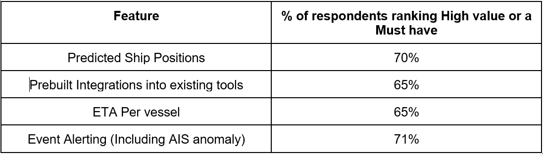
These findings indicate a real expectation gap from dealing with a data stream of millions of NMEA formatted AIS messages!
How to close this expectation gap?
The good news here is that this is a gap that is actually already bridged. Satellite AIS data vendors are delivering refined data and analytics through multiple APIs. They are providing turn-key integrations to leading software platforms and continuously investing in product releases that solve for customers' feature requests.
To help highlight this in action, we wanted to build a berthing identification solution using just AIS data and machine learning. Traditionally, this would have been done by analyzing maps overlayed with marine traffic data. Below you can see the visualizations of the three steps we took to create the waiting areas and terminal identification.
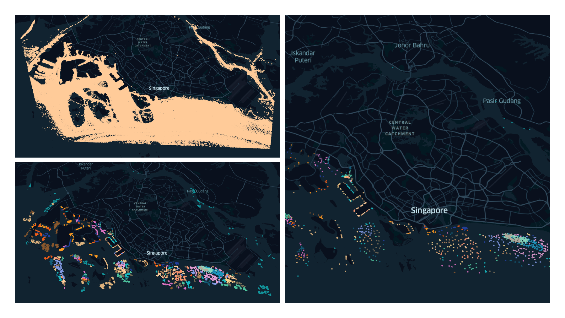
Image source maritime.spire.com
The top left image is unfiltered AIS data tracking around the port of Singapore. The lower left is after clustering processing, resulting in the final step the creation of berths and waiting areas as shown on the right.
This was a great example of solving a problem with modern data methods, and it is indicative of the solutions to many challenges that you can look to solve with satellite AIS data.
Iain Goodridge is the head of product marketing for Spire Maritime.
The opinions expressed herein are the author's and not necessarily those of The Maritime Executive.